GRRRR and I paddled the Roanoke River last month [May 20-26] from Weldon to Plymouth, N.C., or, to put it another way, from just east of I-95 to just west of Swan Bay and the Albemarle Sound – about 113 miles.
And, right off the bat, I want answer the question I’m most often asked when I go backpacking or river running: Did you have fun?
Yes!
After I paddled the Neuse River with Mike Johnson in June last year, I didn’t say “Yes!” to that question. When I posted a story about that trip I said, “Define fun.”
And then I wrote:
“The 225-mile trip from Raleigh to Oriental, where the Neuse empties into the Pamlico Sound, was beautiful, interesting, challenging. I learned stuff — I almost learned how to paddle a kayak. I met some terrific people. I made good memories. I’m glad I went. Everything doesn’t have to be ‘fun.'”
The Roanoke trip was beautiful and interesting, too. I learned stuff. I met some terrific people. I made good memories – and I’m glad I went. I also had fun.
One big reason is that, except for one day when GRRRR and I paddled almost all day in the rain and part of that day in a blinding rain, this trip, while it had its moments, was not nearly so tough mentally or physically.
Are You Interested in Paddling the Roanoke?
What follows is not a blow by blow description of the trip, just some observations and advice for folks who might be interested in paddling all or part of the Roanoke.
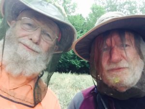
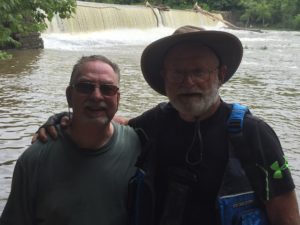
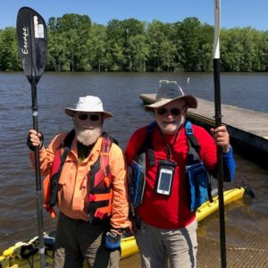
A good trip starts with a good partner and I’ve been blessed twice. Mike Johnson stood up to everything the Neuse threw at us and GRRRR was the same on the Roanoke. He and I got our share of rain, and then some; a few blisters; and, one evening, a gazillion mosquitoes, but it was mostly a hoot.
GRRRR?
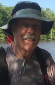
Well, yea, he’s a backpacker who has hiked almost 1,800 miles of the Appalachian Trail. [His real name is Karl Smith, from Vernon, CT. He is 70 years old. I was 74 back in May.] I met him at the Telephone Pioneers Shelter in northern New York two years ago. I was hiking to Maine; GRRRR was section hiking, trying out a knee replacement. He blew out a knee when he attempted a thru-hike of the A.T. in 2013.
[My trail name is “Lucky.” Before I started my thru-hike several friends told me that I was fortunate to have the health to try and a wife who said “Yes”. I didn’t think “Fortunate” had much of a ring to it so I chose “Lucky” for a trail name.]
Here are the two best pieces of advice I have for padding the Roanoke:
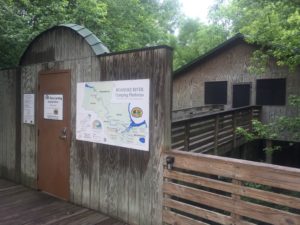
- One, go to the Roanoke River Partners website and study it carefully. Lots of good information there. And here is the RRP Facebook page. You’ll probably want to rent one or more camping platforms from RRP — three of the four platforms we rented were good, no, excellent.
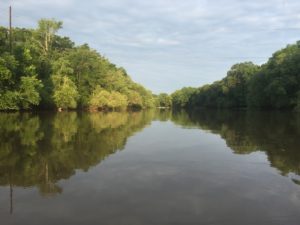
There are places to camp beside the river, but not all that many. The upper part of the Roanoke has high banks, making it hard to land most of the time. You’d have to stand on your kayak or canoe [Good luck!] and start climbing. And the lower part of the river is pretty wet – a lot of swampy areas.
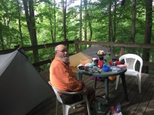
Roanoke River Partners has constructed camping platforms, some on the river and many others on creeks feeding into the river. For two people the cost is $25 per night. The Roanoke River Partners website has all the information, and photos.
- Two, get a GPS. If you don’t have a GPS you’re rarely going to know where you are. There are just not that many landmarks on the Roanoke — bridges, power lines and such. [That’s one of the best parts of this paddle, you’re not going to see a lot of civilization.] Without a GPS you’re going to have a heck of a time locating the platforms you’ve reserved.
Let me say this one more time: TAKE A GPS WITH YOU OR YOU’LL BE SORRY. I don’t think I can say it any plainer than that.
GRRRR and I took our time going down the Roanoke, and we were rewarded for it. We saw a number of bald eagles, including one that glided down right in front of our kayaks, grabbed a fish, and flew back up into the trees.
We had planned to spend six nights and six and a half days on the river, an average just 17 miles a day. That’s a leisurely pace. Mike Johnson and I average a bit over 30 miles a day for the first six days of the Neuse trip. When you’re doing 17 miles a day you don’t have to rush to your kayak or canoe in the morning and you don’t have to swing a paddle all day. You’re done by mid-afternoon. The river level and the current will impact your speed, of course, and that may vary from day to day. On this trip the river was high and we made three to four miles an hour, depending on how energetic we were feeling.
On any backpacking or river trip it’s a good idea to learn as much about the route as possible and plan thoroughly. [GRRRR and I worked on plans for this trip, off and on, for months.] And then, when you get out there, be willing to change your plans on a dime.
This is where we planned to spend each night:
- Night 1, Tillery Platform, mile 15.54.
- Night 2, camp by the river, mile 39.58.
- Night 3, The Bluffs Platform, mile 55.74.
- Night 4, camp by the river near Ft. Branch, mile 69.31.
- Night 5, River Landing Platform, Williamston, mile 89.84.
- Night 6, Cypress Cathedral Platform, mile 104.28
We altered that plan twice after we got on the river.
- The First Day, when we stopped at Tillery Platform to take a look, a convict from nearby Caledonia Correctional Institution, a state prison farm, drove by on a tractor not 30 feet from the platform. I didn’t like that. We moved on down the river a couple of miles and found a good place to camp in the woods, on the other side the river from the prison.
- On the Fourth Day it rained, hard. I said to GRRRR, why don’t we go all the way to Williamston this afternoon, get a hot shower, dry clothes – and food. That meant a 34-mile day in the rain. GRRRR thought about that a few minutes and then I heard him chanting, with each stroke: “PIZ ZA! PIZ ZA! PIZ ZA!”
We paddled on to Williamston and ate pizza that night.
River Landing, where GRRRR and I stayed when we got to Williamston, is the best shelter I have ever seen, and I’ve seen right many, scores, on the Appalachian Trail. There was a flush toilet and hot shower (!) nearby. And there was a lock on the door so we could leave our equipment and walked to restaurants less than a mile away.
That long paddle in the rain put us a day ahead –Brother Dave was scheduled to pick us up in Plymouth at noon on Day 7 – so we took a zero* the next day and stayed at River Landing an extra day and night.
I fished a little that day although I didn’t catch anything.
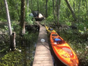
River Landing Platform was a good one, but the platform GRRRR and I liked best was Cypress Cathedral, where we stayed our last night on the Roanoke. Cypress Cathedral is in a swamp, in the middle of nowhere.
It was lovely, serene. A memory.
NOTE:

Carol Shields, director for Roanoke River Partners, Inc., could not have been more helpful, answering numerous questions and referring us to Brad Beggs, a veteran river paddler whose tips on where to camp and how to create a personalized map the Roanoke for my i-phone were invaluable.
Brad told me about this website, “How to Create A Custom Google Maps Itinerary And Use It Off Line,” and I did.
[OK, OK. I didn’t. But one of my grandson, Cole J. Stith, did.]
Brad also sent me beautiful pictures of the river.
Carol practically held our hand.
When we got to Williamston, soaked through and through, we couldn’t could get a hot shower at first because the door to the shower was locked and the key wouldn’t work. Carol had given me her cell number told me to call her if we ran into a problem. I considered no hot shower a major problem. I called her. It was in the early evening, after work hours, but Carol called somebody and pretty soon a town employee showed up and unlocked the door.
So is that all?
No. Like I said, we took a zero the next day and, when Carol learned of a release at the dam upstream from Weldon, she drove 30 miles or so to Williamston to warn us.
* Taking “a zero” means you don’t go anywhere, you make no miles.
Coming Monday: Gone Missing – Part 1 of 8